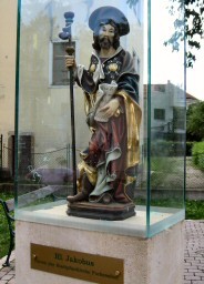
In Purkersdorf we start at Jakobusplatz (St. James place) by the parish church dedicated to St. James.
Since April 10, 2011, the 67-kilometre long Purkersdorf - Göttweig section has been marked with over 200 signposts. The book by Peter Lindenthal served as the basis
for the routing. However, there are some small deviations. A
leaflet
about this section of the Way of St. James provides additional information.
![]() (POP - UP Windows must be allowed!)
(POP - UP Windows must be allowed!)
Here is a PDF of another edition of the leaflet
![]()

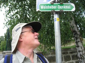
Behind the Purkersdorf church on Jakobusplatz we turn left into Kaiser Franz Josef Strasse and walk a short distance until Berggasse branches off to the right uphill. There you will find this sign.
Adolf Samper was a member of the Austrian Tourist Club Section Wienerwald from 1904 until his death (1949) and worked in this section in various functions. He achieved the greatest recognition and importance as chairman of the marking committee. For this reason the green marked hiking trail from Purkersdorf to the Troppberg was named "Adolf-Samper-Weg" during a ceremony on 3.5.1931.
We follow the green markings, the Adolf Samper Weg. At the end of the Berggasse near the cemetery is another indication of the Jakobsweg.

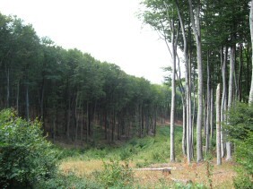
The Wienerwald immediately surrounds us with tranquility. It goes gently uphill.

We are less than 10 minutes away from the cemetery and walk lonely and alone through the Vienna Woods. No disturbing noise, no cars, no train - only a bird is twittering.
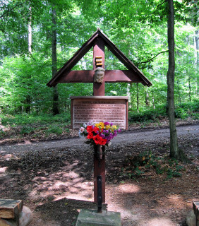
the red wayside shrine, on the way to Troppberg

The path leads steadily uphill.
Sometimes we encounter road signs with faded scallops. Peter Lindenthal placed them.
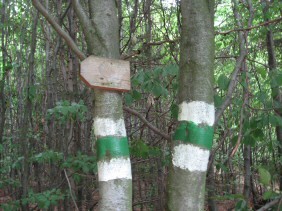
Note the green markings. They belong to the Adolf Samper Way. A map of the Vienna Woods provides information about which markings lead where.
We enjoy the silence of the Vienna Woods. There are hardly any people to be seen. Only occasionally a jogger or biker comes.
Where the green marker meets the blue one and the red one to Riederberg is the turnoff to Troppberg. Although the Jakobsweg leads around the Troppbergspitze, we follow the blue marking uphill (direction Gablitz) to the observation tower.
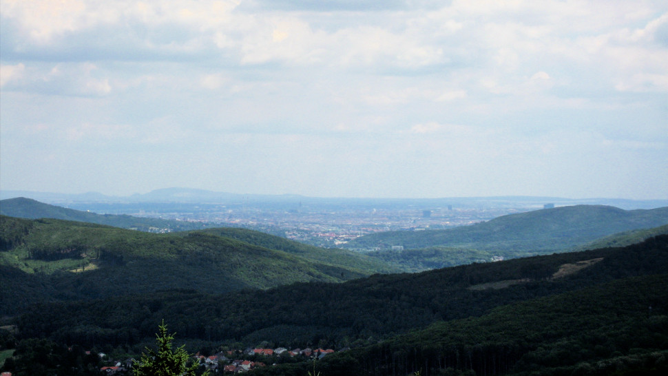
At the top we enjoy the view from Troppberg. The upper picture shows the view towards Vienna.
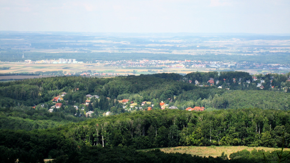
and a view in the other direction to Tulln at the Danube.
Remark: P. Lindenthal mentions in his guide "10 minutes to the Troppbergwarte". That's true, but 10 minutes there, 10 minutes back, 5 minutes up the tower, 5 down and then we want to allow ourselves another 10 minutes for the view... you have to calculate!
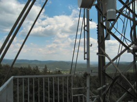
The viewing platform at the transmission mast rises above all tree tops.
The same path leads us back to the Way of St. James, which we now resume following the red markings.
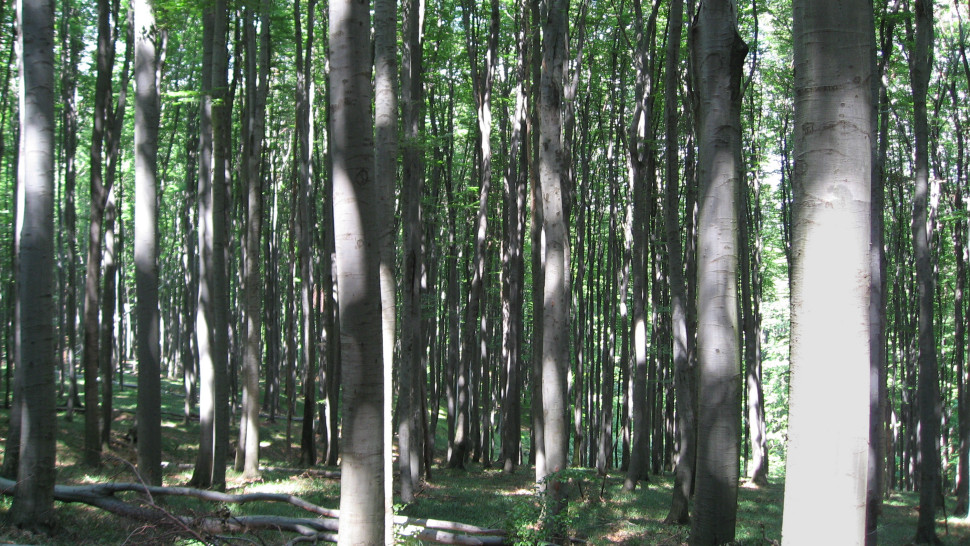
Through the forest it goes downhill again. We observe the play of light and shadows in the Vienna Woods.

Well, we have Peter Lindenthal's guide with us. It is not always easy to find the way, but thanks to the good description in the book, it is no problem.
At this point it says: "The path leads along the edge of the forest for a short stretch on the meadow until it ends at a field. This is crossed diagonally to the left over a length of about 50 m. At the tree at the end of the field you can see the red markings again." And so it is, ...
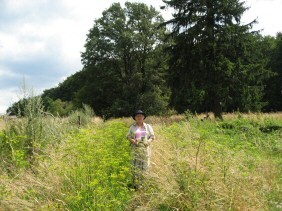
... even though the pilgrim's path leads through high grass.

We change from red to blue markings and follow the sign to the monastery ruins. Here a brook (ravine) must be crossed.

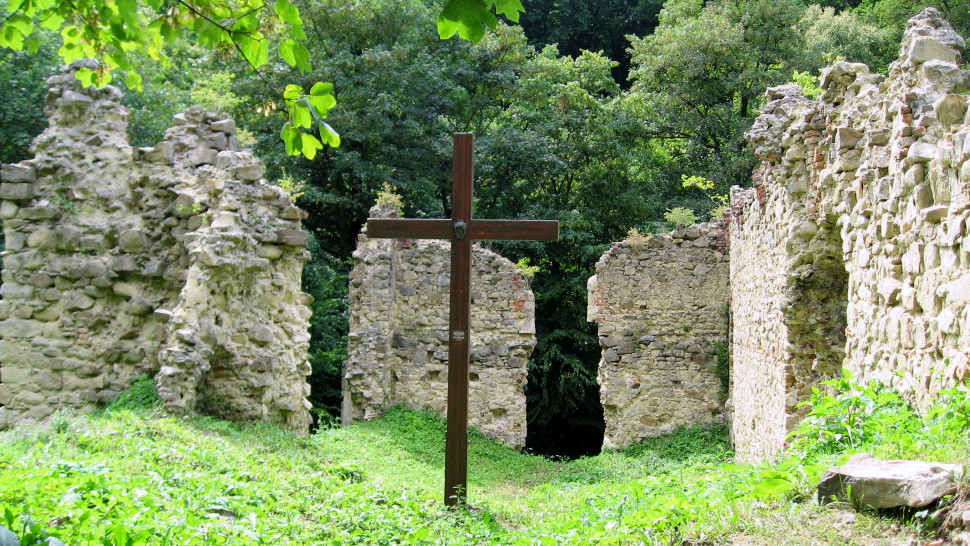
Soon we come to the ruins of the monastery of Sancta Maria in Paradyso or St. Lawrence in Paradise. (Klosterruine)
Already in the 14th century a church of St. Laurentius is mentioned. Gabriel of Verona, at that time vicar of the Austrian province, founded a Franciscan Observant convent on the site in the middle of the 15th century on the basis of a donation by the Habsburgs. The single-nave, late Gothic church was dedicated to the Mother of God and St. Lawrence and was rebuilt after a fire in 1509. In 1529, Turks destroyed the monastery and church, killing 22 friars.
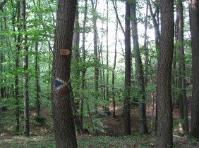
Occasionally you can find signs with shells that Peter Lindenthal has attached.
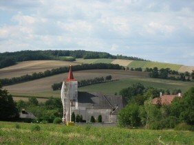
The destination Ried am Riederberg comes into sight.

The stage beer. It's nice to have friends who live in Ried and are happy to be visited.
According to the guide we should need 2.5 hours. But we were on the road for 5 hours. Why is that? Because of the many, many blackberries, the side trip to the Troppberg with climbing the tower and lunch break, the deer we observed, the many drinking breaks (it was quite hot), taking pictures, studying maps and reading the guide.

Vienna - Purkersdorf

to Würmla